 Sealand
Sealand
Sealand
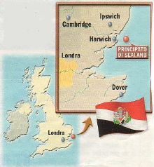 The principality of Sealand is simply a platform made of cement of barely 5.600 square meters, about a soccer
field, and it was built by the English during the second world war as an anti-aircraft placing. It's placed 7 miles
off the seaport of Harwich, not far from London, and it's purpose was to defend the capital city from the
air raids (see the map on the left).
The principality of Sealand is simply a platform made of cement of barely 5.600 square meters, about a soccer
field, and it was built by the English during the second world war as an anti-aircraft placing. It's placed 7 miles
off the seaport of Harwich, not far from London, and it's purpose was to defend the capital city from the
air raids (see the map on the left).
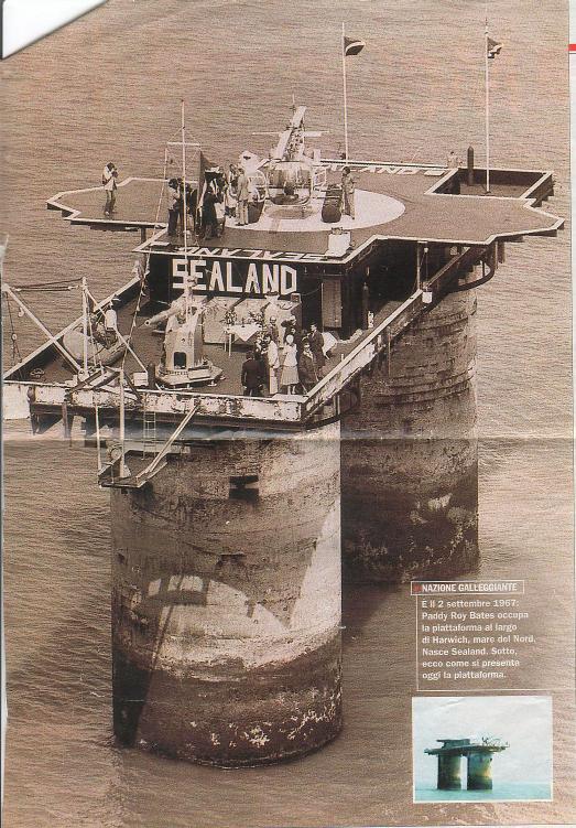
On September the 2nd 1967, the platform was occupied by Paddy Roy Bates, a former Eglish officer, and he declared it a "free and independent state". The English government tried to retake it, but the first time failed because Bates defended it with a small cannon, and then it had to give up because the court of Essex stated that the platform was in the international waters and therefore didn't belong to England.
The dream of the "prince" was to build a casino, a luxurious hotel, a broadcasting station, but nothing of all these got true and today only two people, members of the "Sealand security", live on the platform.
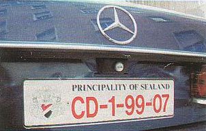
Anyway, though it isn't acknowledged by any state of the world, Sealand mints coins, prints stamps, issues passports (about 160.000 up today) and produces its own license plates, like that shown at the bottom. All this stuff can be obtained with a payment: a kit with driving license, passport and license plate is between 9.000 and 55.000 US dollars.
It's possible to see an interesting picture taken in 1967, when the platform was occupied for the first time, clicking here, so you can understand better the real size of this little "island"!
All the data and the pictures present in this page are taken from the issue of May the 5th 2000 of the Italian magazine Panorama (pages 126-127) and I want to thank Roberto Tarabella very much because he sent them to me!